
What did it take to keep an early city working? Houses and monumental buildings were only part of the answer. A large community also needed food, materials, labour and ways to keep track of what moved between people and institutions.
Uruk, at the site now known as Warka in southern Iraq, offers an early view of these connections. This article follows its watery surroundings, large buildings and administrative records. The evidence lets us investigate the organisation of the city while leaving many details of individual lives uncertain.
At a glance
- Place
- Uruk, at Warka in southern Iraq.
- Focus
- The late fourth millennium BCE, with later evidence clearly distinguished.
- The question
- What did it take to keep an early city working?
A city in a changing waterscape
The dry setting of the ruins can be misleading. UNESCO describes Uruk, Ur and Eridu as cities that developed close to freshwater marshes in the changing deltaic landscape of southern Mesopotamia. Rivers, wetlands and shifting waterways were part of the environment in which urban life took shape. The modern view is not a photograph of the ancient landscape. UNESCO: the Ahwar and the Mesopotamian cities.
That setting changes how we picture the relationship between a city and its surroundings. Water was part of its productive landscape, not simply something beyond the buildings. UNESCO’s assessment brings hydraulic works, storage areas, production spaces and residential neighbourhoods into the same account of these urban centres. Feeding and maintaining a city depended on the connections among such places.
The accompanying illustration offers one imagined view of that relationship: buildings beside water, with reeds, a boat and baskets connecting the settlement to its surroundings. It is not a plan of an excavated neighbourhood or evidence for a particular boat journey.
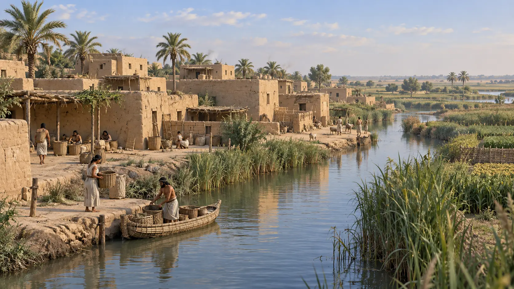
It is therefore useful to think beyond a boundary drawn around the houses. A city could concentrate people and authority while remaining closely dependent on resources outside its built centre.
Building at a scale larger than a household
Some of Uruk’s monumental buildings carried patterns made from coloured cones embedded in their walls. The decoration belonged to a city whose scale, by around 3200 BCE, set it apart in southern Mesopotamia. Its builders were working with mud brick, yet the result was architecture intended to command attention. The Met: Uruk.
The remains of the White Temple and its elevated setting are among Uruk’s most distinctive early monuments. The conservation specialists working there describe structures made largely from earth blocks, including surviving traces of plaster, paint and floors. Those fragile materials can preserve evidence of ambitious construction, even where little of the original height remains. ZRS: conservation of the White Temple.
Reading a monument
- Evidence
- Large structures, earth blocks and surviving finishes.
- Inference
- Construction required materials and labour to be coordinated beyond a single household.
- Open questions
- Who recruited the workforce, how people were supported and how willingly they participated.
Nor should all of Uruk’s sacred architecture be combined into one imaginary skyline. The conservation account distinguishes the early White Temple complex from the substantially later Eanna ziggurat. A reconstructed scene needs a date as well as a place.
Keeping track of grain
A small clay tablet in The Met makes the administrative side of this world more concrete. Dated approximately 3100–2900 BCE, it is catalogued as probably from Uruk. Its numerical marks and other signs are interpreted as an account of barley distribution, most likely associated with a large temple. The findspot and precise transaction remain uncertain. The Met: tablet 1988.433.1.
The tablet also carries impressions from a cylinder seal. Marks used to record quantities thus shared a surface with imagery. The surviving impression shows a male figure with dogs and boars in a marsh setting. The object lets us see accounting and representations of authority together, although it does not preserve the full conversation or procedure behind the account.

Records like this made some information available beyond a person’s immediate memory. Their usefulness lay in enabling quantities and categories to be checked again. Early administrative writing offers a view into that work; it is much less direct evidence for how an individual household experienced the city.
Objects reveal another kind of expertise
A stone bowl fragment from southern Mesopotamia, dated approximately 3300–2900 BCE, preserves a bull whose body is carved in shallow relief while its head projects towards the viewer. The fragment belongs to the artistic world of the Late Uruk and Jemdet Nasr periods; its museum record does not identify Uruk itself as its findspot. The Met: bowl fragment with bulls.
The contrast with an administrative tablet is instructive. One object records an account; the other required a sculptor to work an animal’s body around a vessel’s surface. Urban society involved multiple forms of knowledge. The Met notes that vessels of this kind occur in important religious or palace settings, suggesting special uses. That does not allow us to reconstruct a particular ceremony for this fragment.
Much of the city remains beneath the surface
Excavated monuments are only part of what archaeologists can study. Geophysicist Jörg W. E. Fassbinder describes magnetic surveys at Uruk that trace buried settlement areas, waterways and features associated with the city wall. Such work helps researchers investigate large areas without exposing every building through excavation. Fassbinder: magnetic traces of Uruk-Warka.
The method also has limits. A buried outline may suggest a canal or structure, but its date and function may require excavation. Fassbinder explicitly identifies features for which that remains necessary. Because Uruk was occupied across many periods, a survey map cannot automatically be treated as a complete plan of the city in 3200 BCE.
This is how the picture becomes more detailed: broad surveys identify relationships across the site, while excavations and associated finds help establish what those relationships mean and when they existed.
Where does Gilgamesh fit?
Later tradition associated Uruk’s wall with Gilgamesh. The Met describes him as possibly a historical ruler around 2700 BCE who became the hero of later stories. The distinction separates a literary tradition from a securely documented construction record. It also places the familiar hero after the city’s major fourth-millennium expansion. The Met: Gilgamesh and Uruk.
Uruk’s importance does not depend on proving every later story about it. Monuments, objects, records and traces of waterways already reveal a community working at an extraordinary scale. Its early tablets lead to another question: how did a system for recording things and quantities develop into writing capable of expressing language?