
A drain is an unassuming place to begin the history of a civilisation. Yet it raises questions that a monument can leave unanswered. Where did household water go? Who could reach a well? How did people keep a crowded neighbourhood working?
Harappa and Mohenjo-daro bring those questions into view. They were major centres of the Indus civilisation, whose mature urban phase is generally dated to about 2600–1900 BCE. Across what is now Pakistan and northwestern India, cities, smaller settlements and rural communities formed an extensive network. The story reaches well beyond two famous archaeological sites. Jonathan Mark Kenoyer: Introduction to Around the Indus in 90 Slides
Two cities within a larger world
Harappa is in Punjab, Pakistan; Mohenjo-daro is farther south in Sindh. “Harappan” is an archaeological label taken from Harappa’s name. It does not mean that every community in the civilisation belonged to that one city. Archaeologists have identified settlements of different sizes and functions, including places associated with farming, production and exchange. Jonathan Mark Kenoyer: the urban network
The cities also had local histories before their most recognisable urban forms emerged. Jonathan Mark Kenoyer’s account traces the civilisation’s background through earlier farming and pastoral communities. Exchange connected regions before the mature urban period, moving materials and knowledge as well as finished objects. Urban growth was a process, not the sudden arrival of a complete civilisation from elsewhere. Jonathan Mark Kenoyer: earlier communities and exchange
Streets were part of the city’s working equipment
At the excavated cities, major streets and smaller lanes organised movement between buildings and neighbourhoods. Baked brick was an important material in their architecture, although mud brick was also used. Platforms and successive rebuilding shaped the settlements over time. Jonathan Mark Kenoyer: environment and city organisation
Drainage adds another layer to that street plan. At Mohenjo-daro, surviving brick drains include stretches that were covered. Features described in Harappa.com’s archaeological commentary include settling arrangements and changes made as structures were rebuilt. A drain could be modified and maintained; it was not simply installed once and left untouched. Harappa.com: Mohenjo-daro Street Drains
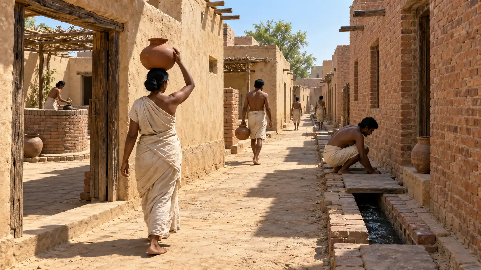
The illustration exposes a drain to make its position visible. It should not be read as evidence that every ancient drain lay open. Nor do the surviving channels establish that every resident enjoyed identical facilities. An archaeological plan records what has been identified in a particular excavated area, not a complete survey of every household that ever occupied the city.
What the drainage evidence does make clear is a connection between individual buildings and shared space. Water leaving a house became a neighbourhood problem. Following its route helps us see the city as a set of relationships between households, streets and the people responsible for keeping them usable.
Wells, washing and access to water
Wells and bathing areas are among the most striking features of Indus urban archaeology. Kenoyer describes neighbourhood wells supplying household washing facilities. At Mohenjo-daro, the large tank conventionally called the Great Bath represents a different scale of water architecture. A public or ritual purpose has been proposed; its precise use remains an interpretation. Jonathan Mark Kenoyer: environment and city organisation
A well and a drain performed different jobs. The well provided access to water; a washing surface and outlet helped people manage water after use. Keeping these functions separate makes more sense of the remains than calling the whole arrangement a modern plumbing system.
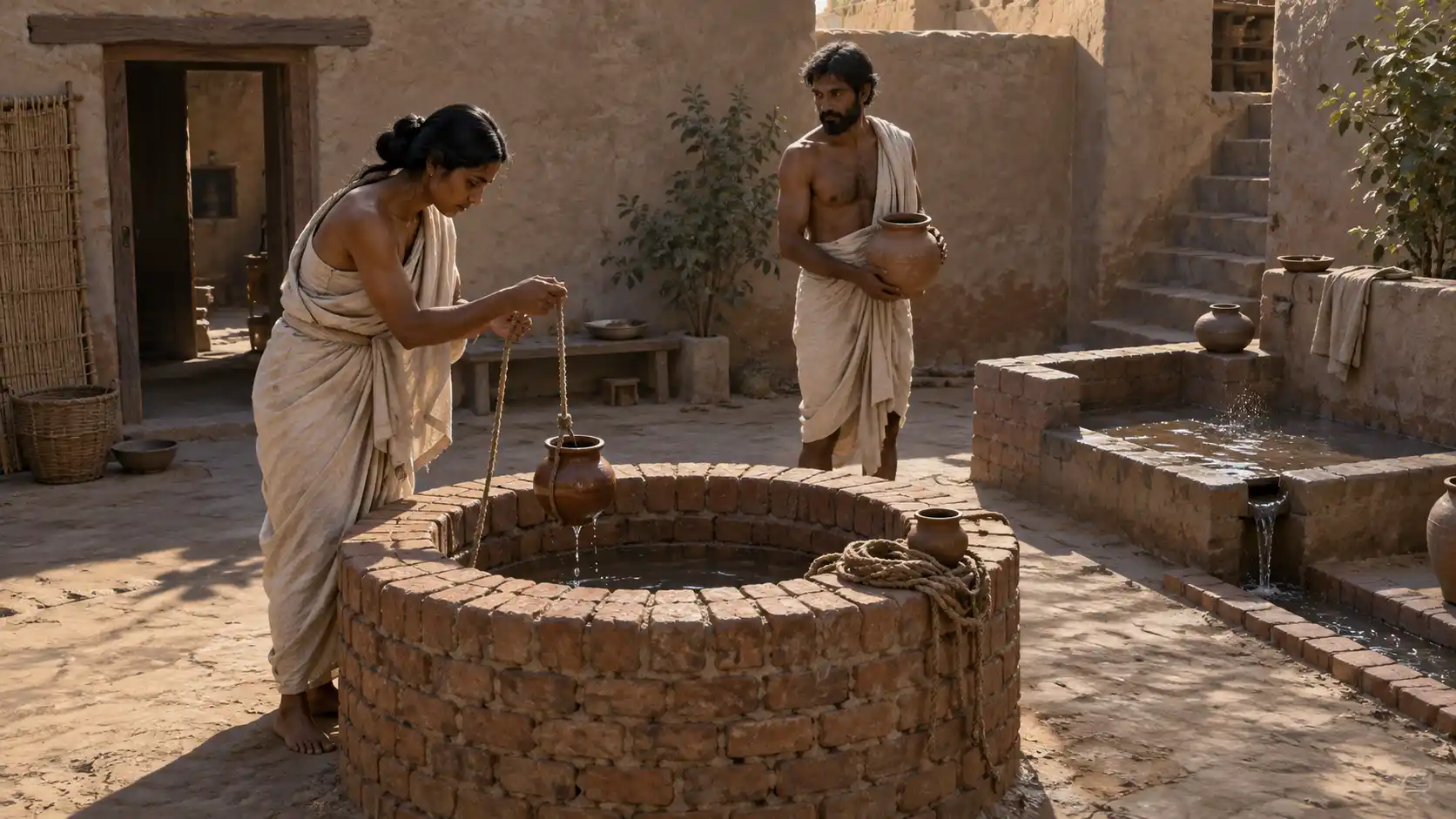
The courtyard image suggests the activity of drawing and carrying water. Its occupants, clothing and architectural arrangement are imagined. It is not a measured reconstruction of a documented house. For the archaeological argument, the significant evidence is the relationship between actual wells, surfaces and outlets.
A city depended on its surroundings
Streets could organise an urban population, but they could not feed it. The Indus world included river plains, pastoral areas, coastal resources and routes into upland regions. Kenoyer’s overview connects urban food supplies with cultivated land, grazing and other resources across this varied environment. Jonathan Mark Kenoyer: environment and city organisation
His discussion of exchange identifies transport by carts, pack animals and boats, alongside a widely shared system of weights. Objects and materials also moved between the Indus region, the Arabian Gulf and western Asia. A finished item in a city could therefore represent several journeys and several kinds of work. Jonathan Mark Kenoyer: trade and exchange
What a bead can reveal
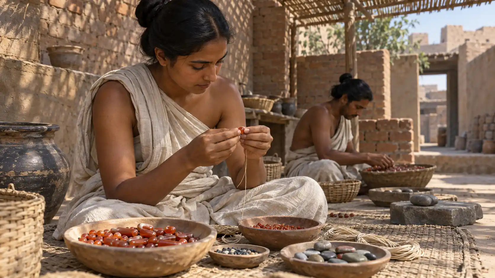
Craft production offers a route into those connections. Indus artisans worked stone, metal, shell and other materials into useful and decorative objects. Beads and ornaments are evidence of specialised skills, while differences in materials raise questions about access and status. They do not, by themselves, tell us the occupation or rank of a particular wearer. Jonathan Mark Kenoyer: craft objects and the Indus script
Kenoyer links the distribution of crafted ornaments with exchange between settlements. The interpretative workshop below gives this part of urban life a human scale. It evokes careful manual work rather than a royal monument; the exact tools, division of tasks and identities of the workers are not recovered facts. Jonathan Mark Kenoyer: trade and exchange
Why the cities still leave questions unanswered
Inscribed seals and other marked objects survive, but the Indus script has no generally accepted decipherment. We cannot read an Indus account of a city council, a ruler’s duties or a workshop agreement as we can read many texts from Mesopotamia. This limits how confidently we can name institutions behind the remains. Jonathan Mark Kenoyer: craft objects and the Indus script
Kenoyer also cautions against the older picture of a uniformly governed society with two capitals ruled by priest-kings. Similar objects and building practices reveal connections; they do not automatically prove one political structure everywhere. Jonathan Mark Kenoyer: research and misconceptions
After about 1900 BCE, the mature urban pattern changed and regional traditions became more prominent. This was not the disappearance of every community or every skill. The shift is better approached through particular places and different kinds of evidence than through a single dramatic ending. Jonathan Mark Kenoyer: regional change and continuity
Harappa and Mohenjo-daro are compelling because so much of their surviving architecture concerns ordinary needs. Their streets, wells and craft objects let us investigate how people shared space and resources, even where the names of the people themselves remain beyond reach.
To explore another urban setting, read how early Uruk worked. That article focuses on an earlier period in Mesopotamia; its evidence should be compared with the Indus cities without treating the two as one urban tradition.