
A paved road above Kavala, an inscription beside the Danube and a harbour at Dubrovnik preserve three different histories of movement. Each depended on a particular combination of terrain, construction and political power. A road needed repairs; a river crossing could become a military target; a ship needed people willing to finance its voyage.
These places help explain how communities in the Balkans connected with wider worlds. Our examples begin with the Roman Via Egnatia in the second century BCE, turn to Trajan’s Danube frontier around 100 CE, and then move forward to medieval and early modern Ragusa, now Dubrovnik. They belong to different networks and centuries.
Three connections, three settings
- Across land
- The Via Egnatia linked Adriatic ports with Macedonia and destinations farther east.
- Along a frontier
- Roman engineering changed movement beside and across the Danube.
- Out to sea
- Ragusa built a maritime economy supported by shipyards, investment and commercial rules.
A road between the Adriatic and the Aegean
The Via Egnatia took its name from Gnaeus Egnatius, the Roman official associated with its construction in the second century BCE. A bilingual milestone found west of Thessaloniki records his name and a distance from Dyrrhachium, modern Durrës in Albania. The stone connects an identifiable official with an organised, measured route. Travellers coming from Italy could cross the Adriatic to Dyrrhachium or Apollonia and continue overland towards Macedonia. Livius: the road and its milestones

The geographer Strabo describes the route in his Geography, drawing on the earlier historian Polybius. His account follows it through Lychnidus, modern Ohrid, and Heracleia near modern Bitola, towards Edessa, Pella and Thessaloniki. He also describes milestones and discusses the conversion between Roman miles and Greek stadia. Even an ancient description of a road involved translating between systems of measurement. Strabo, Geography 7.7.4
Read as a journey, this sequence is more informative than a straight line across a map. Ports provided entry points, mountain country channelled movement, and cities offered successive destinations. A traveller could use a short section for a local purpose without ever crossing the whole peninsula. The same corridor could therefore matter at several scales: to a nearby town, to a provincial administration and to someone travelling much farther.
The places along the way
Farther east, Philippi shows how a route became part of urban history. The city acquired Roman public buildings, including a forum, after the battle fought nearby in 42 BCE. Its later Christian importance was associated with Paul’s visit in the first century CE. The surviving monuments bring military, civic and religious histories into the same place, although their buildings and uses developed at different times. UNESCO: Archaeological Site of Philippi
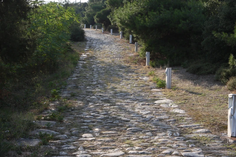
The road itself changed too. Milestones record repairs under emperors including Marcus Aurelius and Septimius Severus, and Procopius later described work under Justinian in the sixth century CE. Maintenance was part of the route’s history. The paving photographed at Kavala should be understood within that long sequence of use and alteration; its appearance cannot date every stone to the first Roman construction. Livius: repairs and later use
Engineering a difficult river corridor
On the Danube, the relationship between water and land required a different response. The Tabula Traiana, on today’s Serbian bank in the Iron Gates region, commemorates road works completed in 100 CE. Its Latin text names Trajan and describes the work on the difficult rocky route. The monument makes the effort visible while assigning the achievement to the emperor. Institute of Archaeology, Belgrade: inscription and date
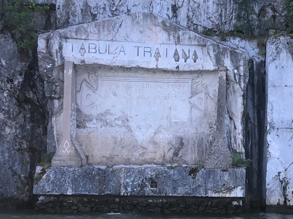

This plaque concerns the road beside the river. A separate project, Trajan’s bridge across the Danube, addressed the problem of crossing it. Cassius Dio’s account admires the bridge’s construction in deep, turbulent water and explains its military purpose: helping Roman forces reach the opposite bank. His narrative also says that Hadrian later removed the superstructure because the crossing could assist an enemy entering Roman territory. This is Dio’s explanation of the decision, preserved in the surviving epitome of his history. Cassius Dio, Roman History 68.13–14
The reversal is revealing. The usefulness of a connection depended on who controlled it and who might approach from the other side. Easier movement could serve trade and communication, but it could also support conquest or expose a frontier. Calling the Danube a boundary captures only part of that relationship.
Today’s view has another historical layer. The Tabula Traiana was moved to a higher position in 1969 because the Iron Gates hydroelectric project would raise the water level. The present relationship between inscription, cliff and water is consequently shaped by modern engineering as well as Roman construction. National Tourism Organisation of Serbia: the monument’s relocation
Ragusa’s connections began at the harbour
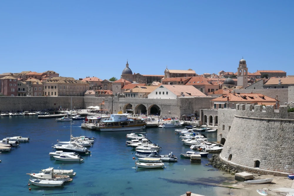
Move forward more than a millennium to the eastern Adriatic. Dubrovnik, historically also called Ragusa, became an important Mediterranean maritime power from the thirteenth century onwards. Here the connection with wider markets depended on a city’s shipping economy. The harbour was a place where maritime journeys met the activities and resources of the surrounding community. UNESCO: Old City of Dubrovnik

Maritime historian Đivo Bašić describes sea trade and land trade as interconnected foundations of Ragusa’s economy. His account also places shipbuilding beyond the old city harbour: yards operated at Ston and on nearby islands, while a new yard at Gruž dates to 1526. The vessels associated with Ragusa therefore depended on a wider coastal zone of skilled work. Bašić: shipping, trade and shipyards
Commercial institutions mattered alongside physical facilities. Ragusa enacted a maritime insurance law in 1568, providing a formal framework for a business in which voyages exposed property to loss. Bašić also records attacks on Ragusan ships by pirates from Rhodes in 1507–1509. Such evidence makes the uncertainties of sea connections concrete: a harbour and a seaworthy vessel did not guarantee a successful arrival. Bašić: maritime risk and insurance
Insurance did not remove those dangers. It organised financial responsibility around them. Seen together, shipyards and insurance rules reveal two kinds of work behind a route: making movement physically possible and making its risks manageable enough for people to participate.
Connections had to be sustained
The old harbour photograph records Dubrovnik in 2025, after centuries of rebuilding. The earthquake of 1667 alone substantially changed the city. Its surviving waterfront helps locate Ragusa’s maritime past, while the history of that past still depends on records of people, institutions and voyages. UNESCO: damage and surviving heritage
Across these three examples, geography provided opportunities and obstacles. Decisions about construction, repair, defence and investment determined how those possibilities were used. This gives the Balkans’ connected history a human scale: a milestone, a difficult crossing and an insured voyage each reveal work that a line on a map leaves out.
For the region’s changing geographical definitions, return to What Are the Balkans—and Where Do They Begin? The published chapters are collected in The Balkans: A Connected History.