
Fort Jesus stands above the entrance to Mombasa’s harbour, its massive walls making a claim about who should control movement by sea. The Portuguese built it between 1593 and 1596. That is almost a century after Vasco da Gama reached the East African coast in 1498. UNESCO: Fort Jesus, Mombasa OpenStax: The Swahili Coast
The interval matters. A first voyage, an attack on a city and the construction of a permanent fortress are different events. Together they form a history of intervention and resistance, not a single moment in which an entire coast changed hands.
Arrival in a world already connected
By the time Portuguese ships reached East Africa, coastal communities had long participated in Indian Ocean exchange. Their arrival did not open an isolated region to the wider world. It introduced new military and political pressures into existing relationships.
Those relationships were not uniform. Malindi’s ruler reached an agreement with da Gama in 1498, while other encounters developed into conflict. In 1505, Francisco de Almeida’s forces intervened at Kilwa and replaced its ruler. The sequence shows both the use of force and the importance of local political divisions. OpenStax: The Swahili Coast
Recognising local decisions does not make the intervention harmless or freely accepted. It helps explain how an outside power could find allies in some places and opponents in others. “The Swahili coast” names a connected region, not a single government capable of making one decision for every town.
What a fortress was intended to do
At Mombasa, Fort Jesus occupied a coral ridge at the harbour entrance. Its position connected defence with access to a valuable port. The National Museums of Kenya identifies Giovanni Battista Cairati as its designer and places the beginning of construction in 1593. National Museums of Kenya: Fort Jesus Museum
The photograph below shows this later phase of Portuguese involvement. Its walls should not be used to illustrate the coast as da Gama first saw it in 1498.
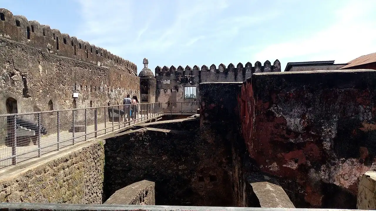

A fort could protect a garrison and help sustain a claim to authority. Its scale also makes the cost of that claim visible: construction, supplies and the continuing presence of people able to defend it. A powerful building is evidence of an effort to hold a position, not proof that the surrounding region was permanently obedient.
The distinction between controlling a harbour and controlling every exchange is equally important. Coastal movement, inland relationships and rival ports did not become a single system simply because one strongpoint had been built.
Kilwa through a European printed view
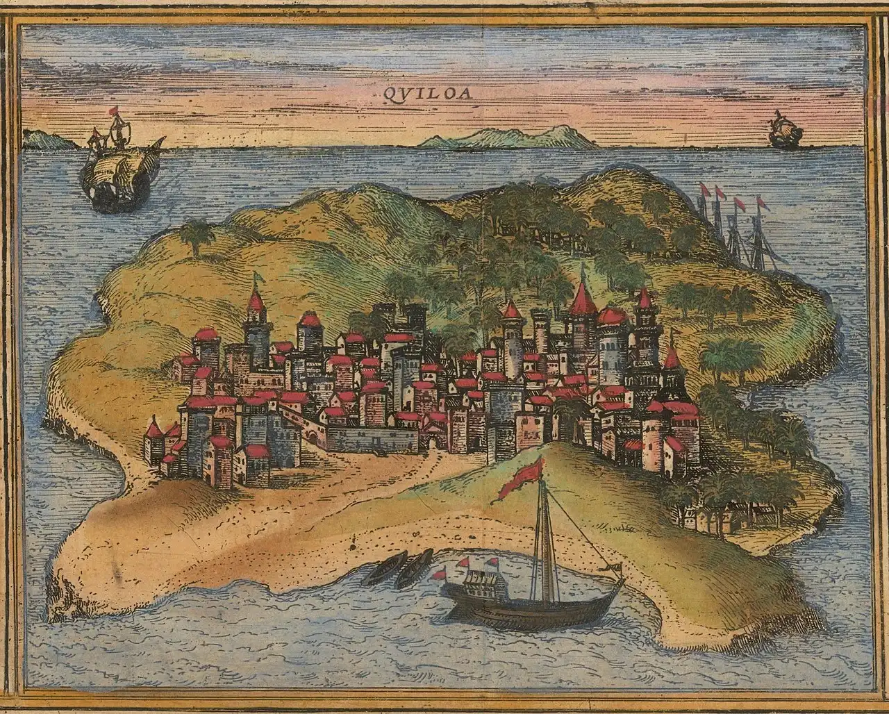
The sixteenth-century print below presents “Quiloa”, an early European rendering of Kilwa’s name. Associated with the city-view tradition of Braun and Hogenberg, it belongs to a different kind of evidence from an excavated wall or a modern measured plan.
.jpg)
A historical picture records a way of representing a place. It may preserve useful information, but buildings can be selected, enlarged or arranged for clarity and effect. The engraving should therefore not be treated as an exact survey of Kilwa at one securely documented moment.
That is particularly important when writing about conquest. A European image or account can bring the ambitions and interests of its makers into the foreground. To understand what happened to a town, historians also need archaeological evidence and sources that let them investigate local responses.
One coast, different outcomes
The map below places Mombasa, Kilwa, Sofala and Mozambique Island within the same geographical frame. It shows locations, not a claim that all were conquered together or governed in the same way.
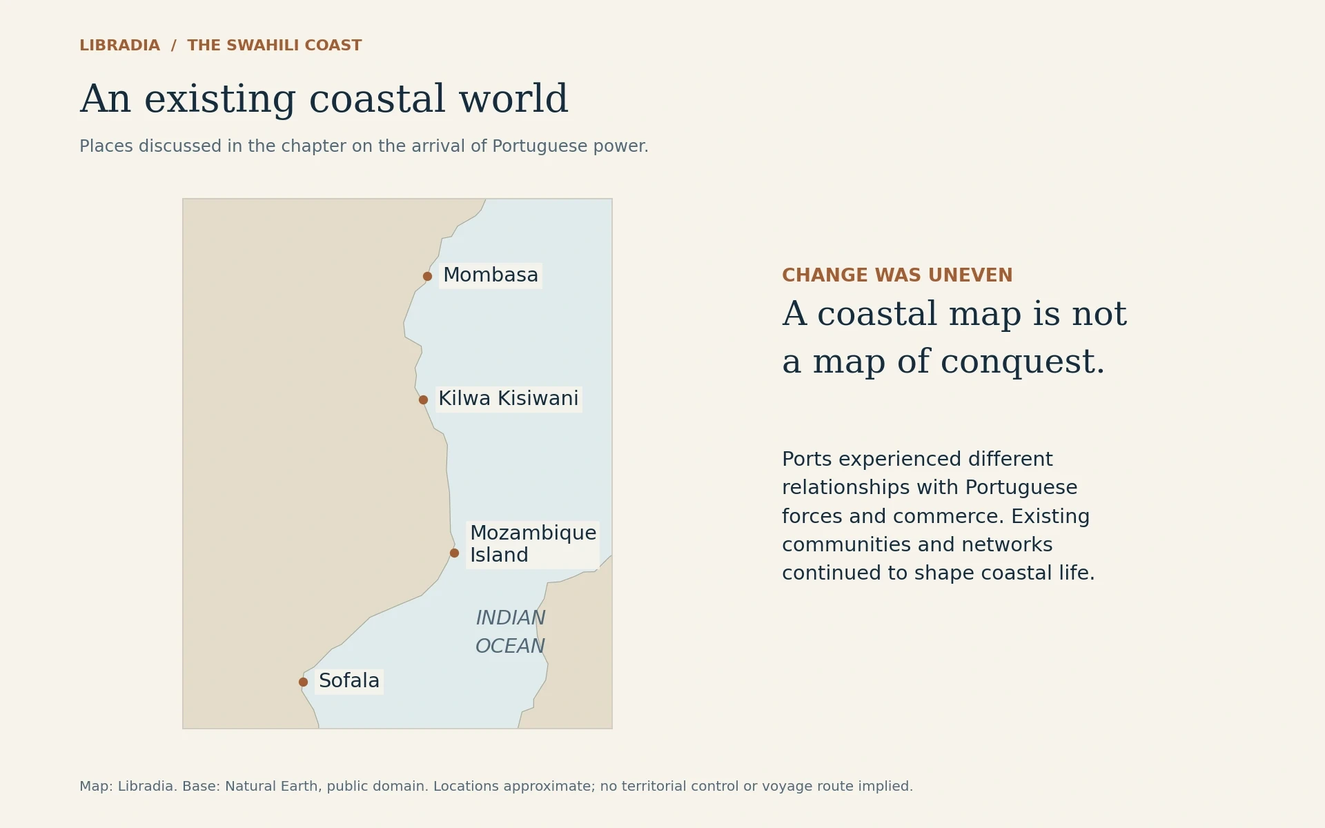
Mozambique Island became a significant Portuguese base on the route towards India. UNESCO describes the island’s urban fabric as reflecting interactions among African, Swahili, Arab, Persian, Indian and European populations. Its history was therefore more complex than the arrival of one group replacing everyone already there. UNESCO: Island of Mozambique
Kilwa, meanwhile, continued to be occupied after its medieval peak. The Metropolitan Museum’s account follows later phases of settlement and changing trade. Continuity did not mean that prosperity or political power remained unchanged; it means that decline in one role was not the disappearance of the place and its people. The Met: Kilwa Kisiwani and Songo Mnara
Looking town by town also prevents every abandonment or commercial shift from being assigned the same cause. A regional label cannot substitute for the chronology of an individual settlement.
Omani power and another change of control
Fort Jesus later became the focus of Omani military action. The National Museums of Kenya records the siege of 1696–1698; the fort fell to Omani forces in 1698. The building that had expressed Portuguese ambitions now entered another phase of its history. National Museums of Kenya: Fort Jesus Museum OpenStax: The Swahili Coast
That change did not restore a timeless earlier world. It altered the balance of power again. Swahili communities continued to navigate relationships with regional and overseas authorities, while later histories of slavery, commerce and colonial rule brought further transformations.
Four dates, different events
- 1498
- Da Gama reaches the East African coast and establishes relations with Malindi.
- 1505
- Portuguese forces intervene at Kilwa.
- 1593–1596
- Fort Jesus is built at Mombasa.
- 1698
- Omani forces capture Fort Jesus after a prolonged siege.
The connections outlasted any one ruler
This series began with communities whose lives linked African landscapes and the Indian Ocean. By the late seventeenth century, the distribution of power had changed substantially, but the coast was still a world of inhabited places, working relationships and movement.
Its history is consequently larger than a rise-and-fall account of prosperous medieval towns. Houses, mosques, objects and fortifications preserve different chapters. Read together, they show people building connections, negotiating unequal power and sustaining lives within a changing oceanic world.